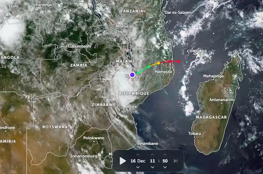
As of 11 AM CAT on Monday, December 16, Tropical Cyclone Chido was located 154 km north-northwest of Nacala, Mozambique.
According to the Joint Typhoon Warning Center (JTWC), the cyclone had been moving westward at a speed of 22 km/h (12 knots) over the past six hours.
Satellite imagery indicated that Chido made landfall approximately 28 km south of Pemba, Mozambique at 6 AM on Sunday. Said the JTWC:
The system, at the time of landfall, had a pinhole eye and a 15/02:53 UTC RCM-1 SAR image showed a vmax of around 220 km/h (120 knots) in a concentric ring 19 km out from the centre.
The system has very rapidly eroded as it moves inland due to terrain interaction and the compact size of the system.
Chido is forecast to track generally west-southwestward and continue rapidly weakening over the next 12 hours with more gradual weakening thereafter.
Dissipation is forecast to occur in 36 hours, and possibly sooner.
According to ZOOM Earth, the eye of Cyclone Chido was positioned just north of Blantyre, Malawi, as of noon on Monday.
More: Pindula News

